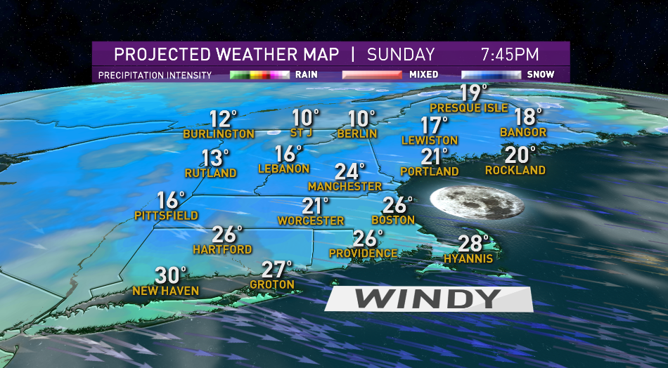
We have to give credit to a storm centered hundreds of miles to our northeast for all this wind.
All those snow showers we had the last few days were weak systems that went offshore and intensified rapidly as they moved north, and then retrograded to the west. A rather unusual event, it’s called blocking in the atmosphere; think of it as a traffic jam for weather systems.
So with the storms intensifying and stalling over Newfoundland, as high pressure builds over Ontario, the pressure gradient gets tighter and tighter. That’s how we generated a wind gust to 157 mph on Mount Washington last night. The temperature on our tallest mountain fell to -18° putting the wind chill value close to 70° below zero.
For the rest of us down closer to sea level, we had wind gusts to 50 mph, putting the wind chill factor just below 0°. But at least the sun is shining! It’s the first day without snow falling in New England in more than a week. In northern Vermont there was a historic snowfall on the southside of Jay Peak Resort where the wind blew it in; we’ve had more than 50 inches since last weekend. But in this kind of wind you can’t really access the upper mountain.
The wind is almost done, and the temperatures are going back up to freezing tomorrow. For the balance of today we hold in the 20s to near 30° with the wind slowly subsiding. A beautiful clear moon tonight with low temperatures not quite as cold as last night, mostly teens and 20s.
We have a nice looking Monday with plenty of sunshine and highs close to freezing south, colder north, but much less windy.
After that the forecast gets very complicated for the rest of the week and into the weekend. A weak low pressure system to our south it’s going to generate snow in New York and probably Connecticut by late Tuesday. For most of us we just stay dry with temperatures in the 30s. On Wednesday and Thursday we’re going to have several waves of low pressure off to the south.
It looks like we should have sunshine for Vermont, New Hampshire, and Maine. There’s a new very cold and dry high-pressure system building into Ontario. Then we see rapid intensification of a storm off the middle Atlantic states Wednesday night and Thursday. It may look like a super storm on the map south of Nantucket by late Thursday and Friday. For now, we believe most of that action should stay out over the ocean, but it certainly bears watching. If nothing else it’s going to bring in some very cold air for the late week, along with some ocean effect snow and another dose of powerful wind on Cape Cod.
So we’ve lowered the temperature for Friday and Saturday and our First Alert 10-day forecast.
"start" - Google News
January 25, 2021 at 05:26AM
https://ift.tt/3ph47rT
Wind Subsides, Cold Lingers to Start Workweek - NBC10 Boston
"start" - Google News
https://ift.tt/2yVRai7
https://ift.tt/2WhNuz0
Bagikan Berita Ini


0 Response to "Wind Subsides, Cold Lingers to Start Workweek - NBC10 Boston"
Post a Comment